


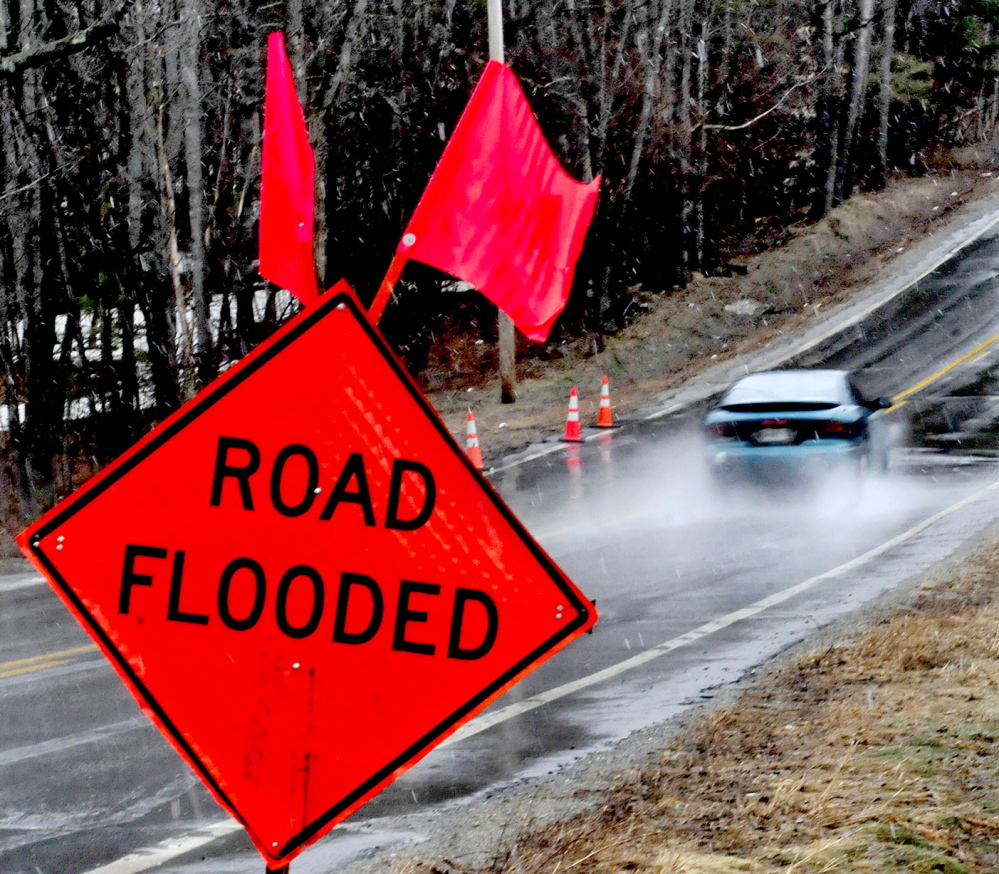
Flood watches remained in effect for most of the state Tuesday, and state emergency officials warned residents that even a small amount of overflow could be dangerous.
As steady rain began to fall across central Maine late Tuesday afternoon, the Maine Emergency Management Agency issued another warning to residents to “turn around, don’t drown.”
Additional Photos
“Flood watches remain in place across all of Maine through Wednesday in response to warm temperatures, snowmelt and today’s rain event,” the news release said. It said the National Weather Service has posted flood warnings for most of the state’s major river systems, “including the Androscoggin, Kennebec, Penobscot, Sandy and Carrabassett.
About 1 to 2 inches of rain was forecast to fall by Wednesday morning, which could raise water levels in area rivers, according to the National Weather Service.
“One to 2 inches of rain is a lot of rain over all those mountains, and Monday’s very warm temperatures melted a lot of snow. The combination means that many areas could be above flood stage on Wednesday,” said Margaret Curtis, a meteorologist for the National Weather Service in Gray.
Tuesday’s news release cautioned the state’s residents to “respect the power of water.”
“A mere six inches of fast-moving flood water can knock over an adult,” it said. “It takes only two feet of rushing water to carry away most vehicles. This includes pickups and SUVs.
“If you come to an area that is covered with water, you will not know the depth of the water or the condition of the ground under the water. This is especially true at night, when your vision is more limited.”
The release says, “Whether driving or walking, any time you come to a flooded road, turn around, don’t drown.”
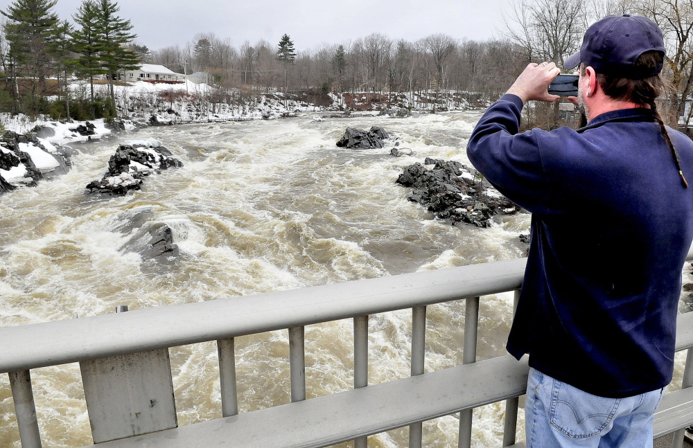
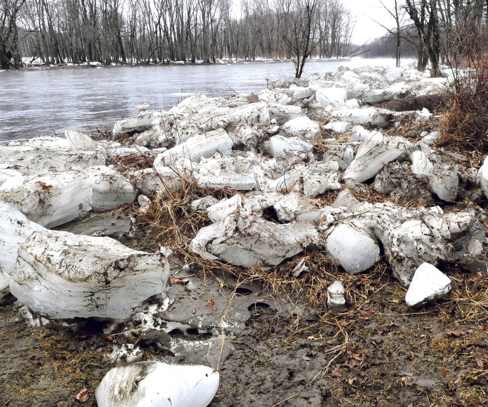
Warm weather on Monday and over the weekend caused several ice jams on local rivers to clear up, allaying some flooding fears.
In North Anson, an ice jam on the Carrabassett River that has been causing flooding on and off since late last week broke Monday night, causing water levels to fall back to normal, Curtis said. By Tuesday morning water levels were at 9 feet, well below the 15-foot level that triggers flood warnings.
Areas of Norridgewock that flooded over the weekend along the Sandy River also have cleared, Town Manager Michelle Flewelling said.
“There was a rather substantial ice jam, but what a difference a day makes. It’s completely clear now, although we are monitoring it,” she said.
With the rain expected to fall through mid-day Wednesday, there is still a strong possibility of flooding in most of the state, according to Curtis.
The Maine Emergency Management Agency has issued flood warnings for the Kennebec River in the Augusta and Sidney areas and Skowhegan, as well as for the Penobscot and Androscoggin rivers.
Yet Somerset County Emergency Management Director Michael Smith said Tuesday he thinks flooding might be avoided on Wednesday.
“It’s hard to tell what’s going to come out of the snowpack in the woods. It will depend on how intense the rain is and how long it lasts, but we’re just kind of watching at this point for any spikes or changes,” Smith said Tuesday afternoon.
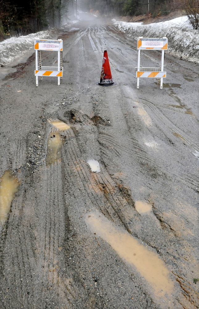
In Skowhegan, interim Fire Chief Shawn Howard said the peak flow of water is anticipated around 8 a.m. Wednesday and there could be moderate flooding in some parts of town. There may be some road closings, but the town does not anticipate major damage or the need for evacuations.
Tim Hardy, director of Franklin County Emergency Management Agency, said no major road flooding had been reported to the county agency as of late Tuesday afternoon. He said the rain had just started to fall, and his agency would be watching to see if any flooding occurred as the rain continued.
“We’re just going to continue monitoring the conditions and see what happens overnight,” he said.
On Tuesday, water levels in both the Carrabassett and the Kennebec rivers were below flood level, but changes could happen overnight, according to Curtis.
“Basically, most rivers in the state will be at or above flood stage by Wednesday morning,” she said.
After Wednesday, the water levels are expected to come down throughout the day Thursday and Friday, she said.
Rachel Ohm — 612-2368 rohm@centralmaine.com
Send questions/comments to the editors.

Success. Please wait for the page to reload. If the page does not reload within 5 seconds, please refresh the page.
Enter your email and password to access comments.
Hi, to comment on stories you must . This profile is in addition to your subscription and website login.
Already have a commenting profile? .
Invalid username/password.
Please check your email to confirm and complete your registration.
Only subscribers are eligible to post comments. Please subscribe or login first for digital access. Here’s why.
Use the form below to reset your password. When you've submitted your account email, we will send an email with a reset code.